Journal of Southern Hemisphere Earth Systems Science
Volume 74
Number 3 2024
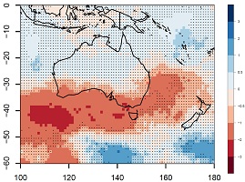
A new convection scheme, ‘CoMorph-A’, has been introduced into the latest UK Met Office coupled (GC4) and atmosphere-only (GA8) models. Our results show improvements over the Indo-Pacific and northern Australian regions, as well as significant improvements in the rainfall bias, Madden–Julian Oscillation simulation and prediction, tropical cyclone forecasts and the diurnal cycle of rainfall over the Maritime Continent. The use of this new convection scheme is promising for improving the simulation and prediction of Australian weather and climate.
Grain production from south-west Western Australia (SWWA) is heavily dependent on rainfall. The Southern Annular Mode (SAM) has been linked to SWWA rainfall variability. This study evaluates growing season rainfall forecasts in SWWA and the simulation and prediction of SAM, using the Australian Bureau of Meteorology’s seasonal forecasting model (ACCESS-S2). The results show limited forecast skill for rainfall but generally good forecast skill for SAM. These results highlight the low predictability for SWWA rainfall and suggest other factors may be limiting model skill rather than the model’s ability to capture SAM.
The planetary boundary layer height (PBLH) measurements are rare at the Great Barrier Reef (GBR), limiting our ability to evaluate weather, climate and air pollution models in this significant region. Here we show that drone-based sampling and Mini-Micropulse (MP) LiDAR, are complementary ways of calculating the PBLH at the GBR. We find the boundary layer to be consistently stable and well-mixed during the campaign, with good congruence between the thermodynamical-derived drone PBLH, and the backscatter-derived MP LiDAR PBLH.
We develop and present a dataset that helps quantify how much more often coastal floods will occur as sea-level rise continues and accelerates. Our dataset is designed so that it is adaptable to any local context, considering relevant planning guidelines, adaptation triggers and flood impacts of concern. Our dataset is analysed to show that once-a-century floods are expected to become chronic occurrences at 85% of Australian locations studied under 1-m sea-level rise.
Extratropical lows and east coast lows cause a large proportion of rainfall in southern Australia during the months May–October. Their frequency varies from year to year, but new data show that they have been becoming less common in recent decades compared to the 1960s. This is contributing to decreases in cool season rainfall in southern Australia. (Image credit: Acacia Pepler.)
This is a seasonal climate summary for autumn 2020, detailing the weather and oceanic conditions and events for March, April and May. During this period south-east Australian rainfall led to flooding and extinguished the remaining fires of the 2019–2020 bushfire season, and 2020 marked the second time that the Great Barrier Reef experienced mass coral bleaching due to elevated ocean temperatures in an ENSO neutral year.
This summarises the southern hemisphere atmospheric circulation patterns and meteorological indices for 2019–20; an account of rainfall and temperature for the Australian region is also provided. The second half of 2019 was dominated by a strong positive Indian Ocean Dipole, before a return to more normal conditions from early 2020. Australia was exceptionally dry in the second half of 2019, which contributed to an extreme fire season. Temperatures were well above average in Australia and the hemisphere as a whole.
A newly discovered erosional scar on the Nullarbor Plain in southern Australia reveals the immense power of tornadoes in shaping the landscape. This scar, identified by satellite imagery, stretches 11 km and is marked by distinct cycloidal patterns, indicating it was formed by a tornado with estimated wind speeds exceeding 200 km h–1. These findings underscore the importance of using modern technology to understand and track tornado activity in remote regions, aiding in better prediction and preparedness for such destructive events.
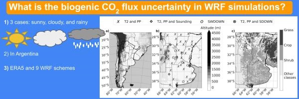
WRF model simulation of meteorological conditions with clear and cloudy skies and frontal passages considering different configurations influences the estimation of surface and boundary layer temperatures, global radiation and precipitation. Error estimation for these varies between 1.87 and 2.33°C, 1.5 and 2.8°C, 4.22 and 7.76 MJ m−2 day−1, and 7.5 and 12.7 mm day−1. These errors propagate into the CO2 flux calculation, resulting in up to a 60% error.
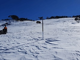
The longest and most complete records of snow depth in the Australian Alps are based on manual measurements made since the 1950s. We investigate the relationship between the frequency of measurements and uncertainty in the records, showing that while uncertainty increases with less frequent measurements, even weekly sampling provides only an approximation of actual snowpack variability in this setting. These findings are relevant to any study making use of Australian snow course data and should inform future snowpack measurement efforts. (Photograph by Sam Bishop.)

