Australian Journal of Botany
Volume 69
Numbers 6 & 7 2021
Special Issue
Vegetation science for decision-making
Guest Editors:
Dr Sarah Luxton (Curtin University)
Dr Donna Lewis (Northern Territory Herbarium)
Dr Shane Chalwell (Plantecology Consulting)
Dr Eda Addicott (Queensland Herbarium)
Dr John Hunter (University of New England)
The aim of this editorial is to introduce the ‘Vegetation science for decision-making’ special issue, which evolved from a symposium at the Ecological Society of Australia’s 2019 annual conference in Launceston, Tasmania. We provide a broad context for vegetation classification in Australia and highlight the main findings of each contribution. It is our hope that the special issue will contribute to a greater understanding of the language, data, methods and applications of vegetation classification, and enhance collaboration between the states and territories.
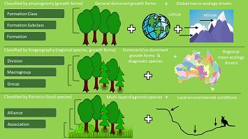
In Australia, ecologists have recognised the need for a quantitative national vegetation classification system to serve a broad spectrum of land management and research needs. Here we provide two case studies of how the International Vegetation Classification approach could potentially provide a framework for the development of an Australian National Classification. We then discuss building the national classification through a collaborative, nation-wide initiative that can incorporate ongoing local and regional efforts while making a unique contribution to the International Vegetation Classification itself.
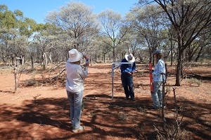
A new approach to classify and map vegetation communities that ensures rare and restricted community biodiversity is considered in conservation planning is outlined. The new method (Data-informed Sampling and Mapping, D-iSM) builds on traditional techniques, using global positioning system (GPS) and geographic information system (GIS) technology to capture data across numerous ground points to guide sampling, classification and mapping.
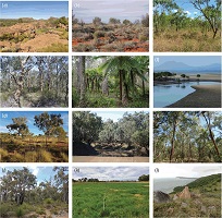
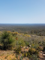
Two methodological approaches (vegetation sampling and hybrid floristic survey) were compared in the Australian monsoonal tropics. Species accumulation-survey effort relationships revealed that saturated-species richness effectively doubled under hybrid floristic survey, and more annual growth forms were detected. Vegetation sampling offers an efficient means of characterising vegetation communities, but taxon-level conservation requires species presence or absence data only obtainable through intensive hybrid survey.
Vegetation classification requires the defining of a hierarchy of types based on a spatial and temporal dimensionality. Here, 108 permanent plots are surveyed across 7 years within the Mulga Lands Bioregion of north-western New South Wales through a drought cycle to assist in incorporating temporal dimensionality within community definition. The changes noted have significant implications for current inflexible vegetation classification methods, benchmarking and threatened community listings. The use of permanent plots in assisting in vegetation classification is recommended at least for threatened communities and highly dynamic vegetation types.
The Regional Ecosystem (RE) classification system, with accompanying mapping, is used in the state of Queensland for conservation management. This paper discusses the RE system in a global context and outlines an updated, quantitative based, classification approach for identifying vegetation communities within it. The paper finally discusses the implications and implementation of the updated approach.
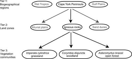
In areas of poor plot data, limited funding and expertise, alternate approaches are needed to create elements of a hierarchical classification schema to assist in landscape planning. We used generalised dissimilarity modelling (GDM), which models species turnover between pairs of 0.01° grid cells as a function of environmental differences between those cells. Here we created a subjective semi-supervised alternative protocol to fully supervised classifications within areas of disproportional and often poor plot data coverage, using individual species occurrences from accessible databases.
Comparing the ability of different field data subsets and pre-treatments to reproduce an intuitively derived vegetation classification within the Australian tropical savanna biome. Three data pre-treatment options (square root, fourth root and presence or absence) were applied to data subsets (all strata, upper strata, ground strata and tree basal area). Square root-transformed data for upper strata species with ≥0.5% cover abundance were optimal for deriving floristic associations akin to those derived intuitively for the vegetation classification.
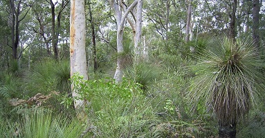
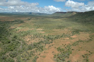
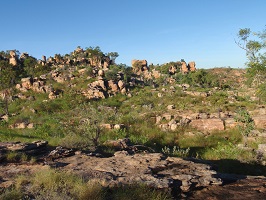
In the Mediterranean Jarrah forests of south-western Australia, new data (30 000 plots) enable updated classification. Results show an upland and riparian supergroup, and higher heterogeneity at the community scale than is captured by the current mapping, with implications for conservation management.
A seamless remnant vegetation-mapping dataset for broad vegetation has been created for eastern NSW from existing legacy vegetation mapping data for the most part at a scale of 1:25 000 and, in one instance, at 1:100 000. The method involved collating vegetation-mapping data for that area and then classification of vegetation-map units from those legacy maps into 57 broad vegetation categories equivalent to Level 5 (macrogroups) in the international vegetation classification (IVC) system.
This paper provides an overview of vegetation plot-data collection, storage and classification in the Northern Territory. The vegetation plot data maintained by the Department of Environment, Parks and Water Security was appraised in terms of the six National Vegetation Information System (NVIS) vegetation hierarchy levels. As a result of inconsistencies between surveys and varying degrees of floristic and structural information collected in the field, 49% of the Northern Territory plot data are compliant with the NVIS vegetation hierarchical levels.
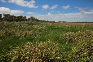
Ephemeral wetlands form complex mosaics. Unpredictable wetting and drying events of variable duration create diverse patterns that are lost when using from simplified classifications. A hierarchical classification based on adequate sampling gives better understanding of these complexities so that management and conservation targets are not misdirected particularly for benchmarking and offsetting. Highly dynamic systems require specialised more intensive sampling over extended periods. Highly dynamic systems do not fit easily within standard survey, mapping, management and conservation methods.