Landforms and soils of Two Peoples Bay Nature Reserve, Western Australia
W. M. McArthur A † , G. A. Bartle A † , K. A. Evans B * and I. M. Tyler
  C D
C D
A Formerly of:
B
C
D
† Deceased. W. M. McArthur and G. A. Bartle were contributors to the original version of this paper, which was written for a special bulletin of on the natural history of Two Peoples Bay Nature Reserve, but never published.
Handling Editor: Mike Calver
Abstract
This paper is one of a series on the natural history of Two Peoples Bay Nature Reserve on the south coast of Western Australia.
Landforms and soils of the Reserve were mapped by W. M. McArthur and G. A. Bartle in the mid- to late 1980s with some verification by K. A. Evans in 2023–2024.
A map of the landforms and soils of the Reserve is presented. The complex and variable topography and soils have arisen through a combination of in-situ weathering processes, transportation of dune sands, and lacustrine deposition.
The topography and soils of the Two Peoples Bay Nature Reserve are complex and variable.
The distribution of the landforms and soils of the Reserve can be explained by the geological and geomorphological framework described in the paper.
Keywords: aeolian, coastal, dune, granite, lacustrine, landform, soil, Two Peoples, Western Australia.
Introduction
In the late 1980s, Angas Hopkins and Graeme Smith edited a collection of papers on the natural history of Two Peoples Bay Nature Reserve, a particularly important reserve on the south coast of Western Australia. Despite the papers being subject to peer-review, revised, and accepted for publication as a special bulletin of CALMScience, the papers were never published (Hopkins et al. 2024). Recently, the collection was resurrected, with contributors asked to bring the papers up to date and submit them for publication in a collection of Pacific Conservation Biology. The original version of this paper was written by W. M. McArthur and G. A. Bartle, both of whom died some time ago. As an understanding of the soils and landforms of Two Peoples Bay Nature Reserve is essential to understanding the natural history of the reserve, K. A. Evans agreed to revise the original manuscript for the special issue.
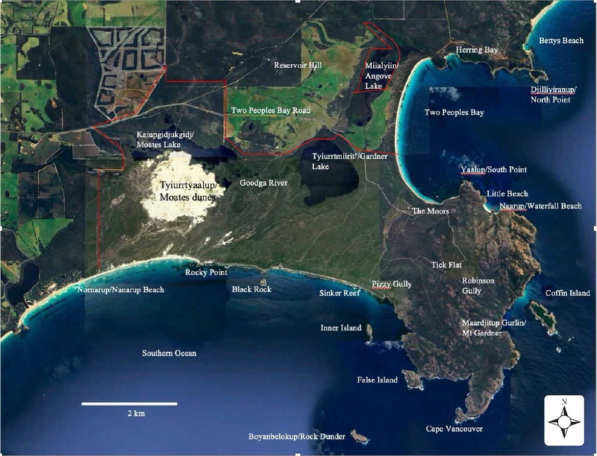
In the south coastal region of Western Australia, variations in landscape features are clearly related to geological events and processes (Churchward et al. 1988). This relationship is exemplified in and around Two Peoples Bay Nature Reserve, where many of the landscape elements of the Albany coastal region are represented (Fig. 1). This relationship is described in this paper.
Two Peoples Bay Nature Reserve (boundaries shown in red) and locations mentioned in the text. Noongar names, where known, are given before the European name and are from Knapp et al. (2024). Source Google Earth. This map includes data from: GoogleAirbusData SIO, NOAA, U.S. Navy, NGA, GEBCOLandsat/Copernicus.
Landscape development
The geological history of the south coastal region extends back to the Mesoproterozoic (1.6–1.0 billion years ago) and includes the period during which what is now the Australian continent formed part of the super-continent of Gondwanaland (Tyler et al. 2024). This land mass existed until the late Mesozoic, at ~100 Ma, when India drifted away to the north-west thus forming the western coast of Australia. Australia and Antarctica separated, with Antarctica drifting southwards, from around 83 Ma, to establish the gross shape of the Australian continent. These older events are described in detail by Tyler et al. (2024). By the Eocene (56–34 Ma), the present coastal area was submerged, with only the higher granite hills projecting as islands and reefs. The ocean was probably approximately 100 m deeper than present and, during this period of submergence, the sediments of the Plantagenet Group were laid down in the middle to upper Eocene (50−34 Ma). The earliest of these sedimentary rocks are limestone and sandstone, which are overlain by siltstone. These sedimentary rocks do not crop out within Two Peoples Bay Nature Reserve, but there is an excellent exposure in a cliff at Herring Bay (Fig. 1). Locations mentioned in the text are shown in Fig. 1.
During the late Paleogene/early Neogene period, at around 20 Ma, the current coastal exposures emerged from the ocean. At this time, the granite basement with its prominent hills and associated marine sediments became part of the Australian continent, and the approximate current position of the coastal zone was established.
The remainder of the Neogene, and perhaps into early Pleistocene times, up to ~1 Ma, was a period of landscape stability during which sediments and granite alike were subjected to intense weathering to form a surface mantle of weathered material capped by lateritic duricrust. Only higher parts of the granite hills projected above the laterite surface. Also, during this period, the Plantagenet sediments were eroded by wave action so that the shoreline consisted of a low scarp interrupted by granite hills and headlands, with near-shore granite islands. The end of this period saw the development of a narrow, low-lying coastal plain, which may have reconnected Maardjitup Gurlin/Mt Gardner to the mainland. Noongar names for landscape features, where known, are given before European names and follow Knapp et al. (2024).
It was during this time, and especially since the middle Pleistocene (1.8–0.774 Ma), that the present landscape evolved towards its present form. During times of low sea level (ice ages or glacial phases), calcareous detritus was blown from the continental shelf to form huge transgressive dunes; this process occurred several times, with each phase overlying the previous dune surface. This material quickly became lithified by solution and redisposition of carbonate minerals, mainly calcite, to form a soft carbonate-cemented aeolian calcarenite, commonly but erroneously referred to as limestone. This unit, which is the stratigraphic equivalent of the Tamala Limestone, effectively linked the granite headlands.
The sea level rose to around +2 m above its present level around 6000 years ago (Baker et al. 2005; Murray-Wallace and Woodroffe 2014), and this is recorded by present-day near-shore environments. The carbonate-cemented sandstone was readily eroded by wave action and so the shoreline gradually took on the familiar form of granite headlands linked by smooth, curved carbonate-cemented sandstone barriers with a steep scarp to seaward (e.g. Sinker Reef). In addition, lower-lying land is thought to have been episodically inundated by shallow water. Between inundations, these areas formed a series of shallow, swampy inlets.
From the beginning of the Holocene (~10,000 years ago), periods of landscape instability are indicated by wind-reworking of sand from various sources to form sand sheets, dunes, and dunefields. At this time, a complex system of both transgressive dunefields and parabolic coastal dunes was blown inland to partially cover prior land surfaces and produce the present coastal landscape (Hesp 2024).
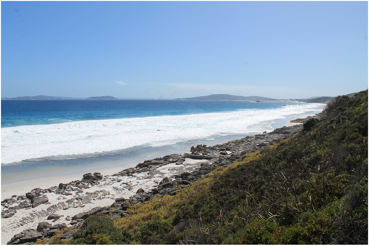
From ~5000 years ago, the sea level fell by ~2 m to its present position (Playford and Leach 1977; Baker et al. 2005). At this time, the wave-cut bench formed at the previous sea level was stranded, where it remains as important evidence of sea-level changes. This platform is well expressed along the coast between Sinker Reef and Rocky Point (Fig. 2). Similar benches, representing previous sea level stands, occur below sea level. At the same time, land in the isthmus between Maardjitup Gurlin/Mt Gardner and Kaiupgidjukgidj/Moates and Tyiurrtmiirity/Gardner Lakes emerged to just above sea level to form two inlets and associated flat, swampy land. The most westerly inlet, which probably included the present Kaiupgidjukgidj/Moates and Tyiurrtmiirity/Gardner Lakes, may have met the ocean near Rocky Point. The inlet related to Miialyiin/Angove Lake was probably much the same as it is now.
Limestone platform at Sinker Reef along the southern shoreline of Two Peoples Bay Nature Reserve (Photograph credit: KA Evans).
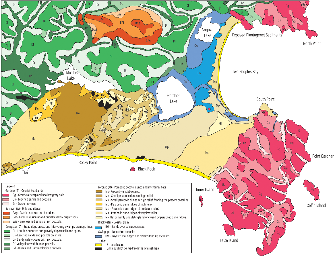
The landscape features mentioned above have been studied, both in the field and from aerial photographs, and classified to form a system of landform–soil mapping units. Maardjitup Gurlin/Mt Gardner and Boulder Hill, with the associated sand deposits, are referred to as the Gardner unit (Fig. 3). Reservoir Hill, which was subjected to laterite formation, is mapped as the Barrow unit. The Plantagenet Group of sediments, with lateritic surfaces and showing erosional modification, is known as the Dempster unit. The Meerup system of parabolic dunes, with four phases of activity, occur as a partial cover over the Gardner and Dempster units and almost completely obscure the carbonate-cemented sandstones. The swampy country associated with Tyiurrtmiirity/Gardner and Miialyiin/Angove Lakes is mapped as the Owingup unit, and the sandy plain between the lakes is separated as the Blackwater unit. These last two units are partially obscured by the latest phase of the Meerup dunes.
Map of the landforms and soils structure in the Two Peoples Bay area. See Table 1 and the text for detailed unit descriptions. Readers should note that in the 1980s when this mapping was conducted, transgressive dunefields such as those along the Nanarup coast were commonly mapped as parabolic dunes as shown here (compare fig. 2 in Hesp (2024)).
Description of the mapped units
The map presented here provides the most detailed map available of the soils and landforms of the Two Peoples Bay Nature Reserve (Fig. 3). The map was digitised from a hand-drawn map by William McArthur, supported with information by Churchward et al. (1988) where handwriting was illegible. Mapping involved ground traverses along roads and tracks, supported by stereoscopic interpretation of 1:40,000 aerial photographs in black and white, and colour where available. Units were defined based on soil morphology. K. Evans and I. Tyler visited the area in 2024 and verified the mapped units within selected areas. The 1:100,000 map of Churchward et al. (1988) provides an overview of the area and uses many of the same units and descriptions. However, there are some site-specific variations, which are summarised in Table 1. In addition, many of the units show variable colour and thickness of soil horizons, and incidence of rock outcrop.
| This paper | Unit description | Churchward et al. (1988) | |
|---|---|---|---|
| Gardner (G) – Coastal headlands; >60 m relief; steep irregular rocky crests and upper slopes separated by smooth sandy tracts; deep erosion ravines | |||
| Gg | Granite outcrop and shallow gritty soils | Same | |
| Gs | Leached sands and podzols | Same | |
| Gr | Erosion ravines with sandy slopes and granite exposed in channels | Not included | |
| Barrow (BA) – Hills and ridges >60 m relief; granite outcrop on crests; gently-sloping flanks | |||
| BAg | Granite outcrop and boulders | Same | |
| BAf | Lateritic duricrust and gravelly yellow duplex soils | Same | |
| BAs | Grey leached sands or iron podzols | Not included | |
| Dempster (D) – Broad ridge crests and intervening swampy drainage lines | |||
| Di | Lateritic duricrust and gravelly duplex soils and spurs | Dc | |
| Ds | Leached sands and podzols on spurs | Same | |
| Dr | Sandy valley slopes with iron podzols | Ds | |
| Df | Valley floor with humus podzols | Ds | |
| Dd | Dunes and hummocks; iron podzols | Ds | |
| Meerup (M) – Parabolic coastal dunes and interdunal flats overlying various substrata | |||
| Mu | Presently unstable sand | Same | |
| Mf | Flat or gently undulating land enclosed within parabolic dune ridges. The soils are generally sandy, sometimes swampy and reflect the character of materials in adjacent ridges and substrate | Same | |
| My | Small parabolic dunes of high relief, fringing the present coastline, representing the youngest phase of the Meerup system. The sand is calcareous to the surface and is characteristically loose and unstable | Same | |
| Me | Small parabolic dunes of high relief, which have originated as a fringe along Two Peoples Bay from an easterly wind. They are siliceous throughout the profile and show little soil development | Not included | |
| Mc | Parabolic dune ridges of high relief forming the next member of the Meerup Dunes. The material shows slight soil development with a faintly calcareous organic stained surface overlying strongly calcareous sand | Same | |
| Mp | Parabolic dune ridges of moderate relief, forming the next member of the Meerup Dunes. The soil is a weakly developed podzol with white sand over a light-yellow brown B horizon at ~1 m and then passing into calcareous material at ~1.5 m | Same | |
| Ms | Parabolic dune ridges, of very low relief, making up the oldest member of the Meerup dune system. The soil is an iron podzol with white sand over a B horizon of yellow-brown sand at ~1.5 m; soft ferruginous concentration may occur at lower levels | Same | |
| Blackwater | |||
| BW | Blackwater (BW): – Coastal plain of very low relief, generally mantled by sand. Soils recognised are deep siliceous sands, peaty sands, and shallow siliceous sands over calcareous clay | Split into BWp and BWo | |
| Owingup | |||
| OW | Lacustrine deposits, consisting of low ridges and intervening swales, fringing the lakes. The materials show layering and consist of organic loam, sand, and estuarine shell deposits; seasonally flooded | Same | |
Subsequent to production of the map provided here (Fig. 3) and the map of Churchward et al. (1988), a range of remote-sensing and geochemical techniques, including the use of machine-learning algorithms, have been applied to map landforms and regolith across the Albany–Fraser Orogen, including the Two Peoples Bay Nature Reserve, and the adjacent Yilgarn Craton (González-Alvarez et al. 2016a, 2016b; Pernreiter et al. 2018). The aim of these studies, to a large extent, has been to improve mineral exploration techniques. Although these studies emphasise the importance of the processes discussed above, such as transgression and regression of the ocean since the Eocene, the patterns and processes that are relevant to the Two Peoples Bay Nature Reserve remain fundamentally unchanged from those discussed here, by Churchward et al. (1988), and by Hesp (2024). In addition, although the areas mapped are much greater than those described here, the spatial resolution of these techniques are much less than the spatial resolution of William McArthur’s hand-drawn map, and they have not been verified in the area of the Two Peoples Bay Nature Reserve. For this reason, these studies are not discussed further.
Gardner (G)
This is a landscape of rocky hills, with greater than 60 m relief, partially blanketed by sand (Fig. 4). The presence or absence of sand is the main basis for subdivision. The crests and upper slopes (Gg) are dominated by granite outcrop and boulders. These are represented in Two Peoples Bay Nature Reserve by Maardjitup Gurlin/Mt Gardner and Tor Hill. On gentler slopes there may be a shallow soil of gritty loam over gritty clay with granite at 15–20 cm depth, or shallow peaty sands in some hollows.
Exposed granite section on Maardjitup Gurlin/Mt Gardner, looking south-west from the track to Sinker Reef (Photograph credit: KA Evans).
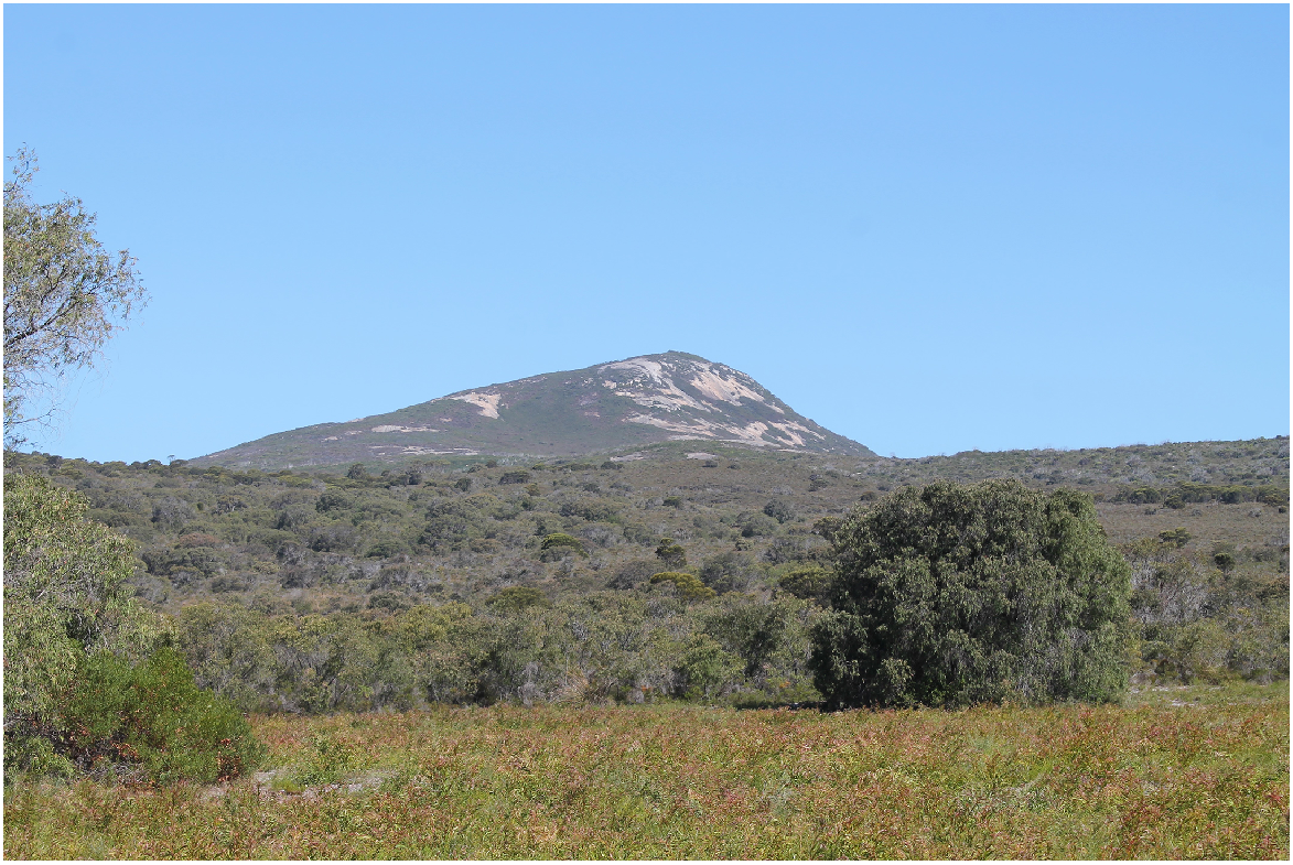
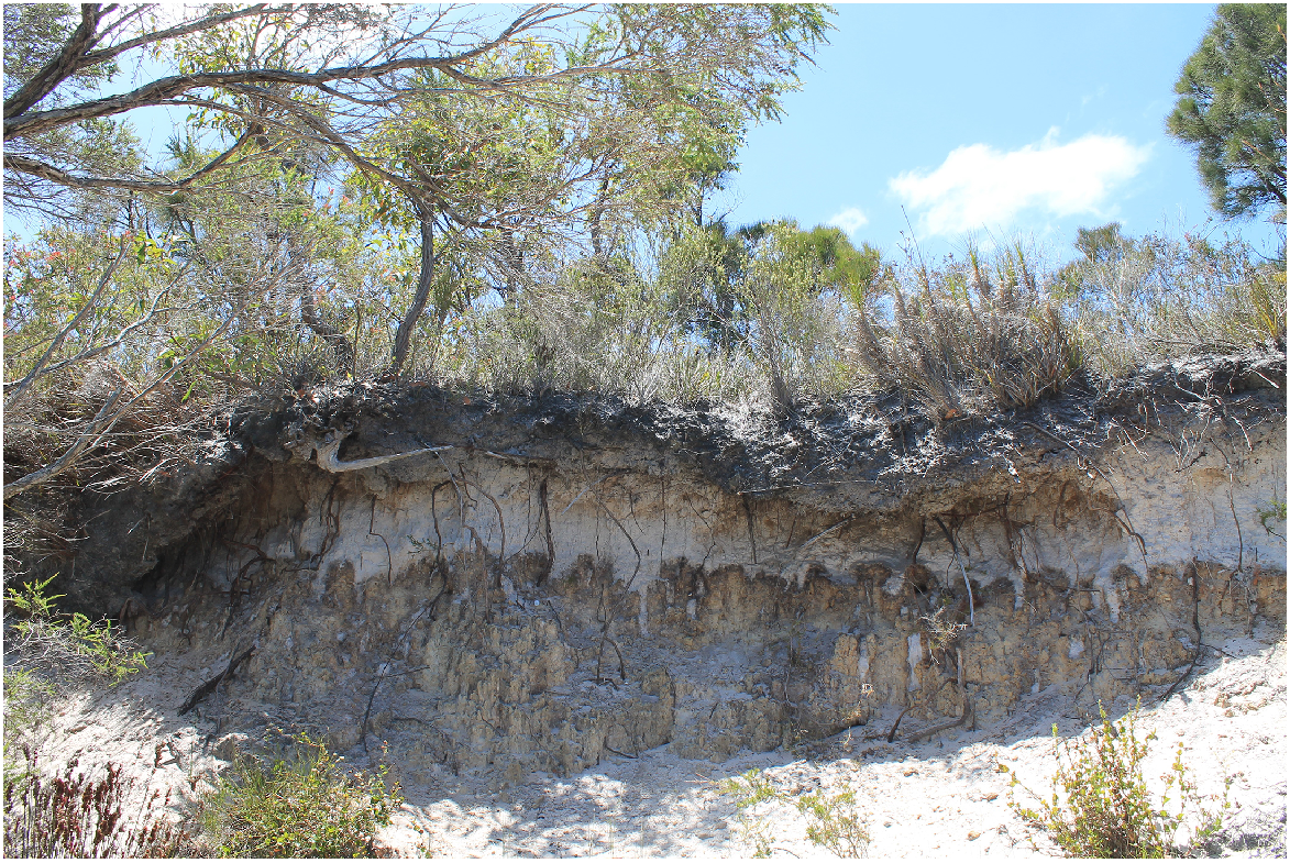
Gardner Sand (Gs) occurs as a smooth landscape between the granite crests and extends down on the gentler slopes. The localities known as Tick Flat and The Moors are parts of Gs unit. The upper parts of the Gs unit, between the granite crests, are poorly drained and this is reflected by the humus podzol profile. The surface is very dark and there is an iron–organic hard pan at 1–1.5 m; granitic detritus commonly occurs in the lower layers. On the flanks of Maardjitup Gurlin/Mt Gardner, the sandy landscape is well drained and soil is an iron podzol with a grey sandy surface, a light grey sub-surface, and a bright yellow-brown sandy subsoil which is often indurated. On the northern flank of Robinson Gully is an exposure of indurated yellow-brown sand, ~5 m thick, which is probably a remnant of such a profile.
Run-off from the granite peaks is very high and this has resulted in the formation of spectacular erosion gullies (Gr). Many of these have been identified because they are the favoured habitat of the Djimaalap/noisy scrub-bird (Atrichornis clamosus) (Smith and Forrester 1981). The gullies usually have steep, sandy slopes with granite outcropping in the floors. Many of gullies are aligned northwest–southeast, and may reflect jointing patterns within the granite basement.
Barrow (BA)
This unit comprises hills and ridges, often with irregular crests and upper slopes dominated by granitic pavements, domes, pinnacles, and tors. Local relief is in excess of 60 m and frequently more than 100 m. This unit occurs only on Reservoir Hill to the north of the Reserve (Figs 1 and 3). Granitic rocks outcrop on the crests and upper slopes, whereas on the lower slopes these rocks are deeply weathered and may be overlain by a sandy mantle. Some Plantagenet sediments may be present on the lower slopes. Yellow duplex soils are dominant but there are some gritty loams. Three subdivisions have been recognised, mainly based on the incidence of granite outcrop.
BAg represents crests and upper slopes dominated by granitic rock outcrops; some shallow brown, gritty loamy soils are on the fringes of granitic outcrops, along with some pockets of gritty yellow duplex soils. BAf comprises the smooth, gently-sloping, middle and lower slopes that are dominated by yellow duplex soils having sandy A horizons and pale yellow and brown mottled clay B horizons. A2 horizons are present, often with lateritic gravel, but they are not usually bleached. The surface may have a scattering of lateritic duricrust boulders. Extensive areas of deep sands (yellow or grey) occur on the lower slopes. BAs is formed by grey leached sands or iron podzols, which represent advanced weathering of the granitic rock.
Dempster (D)
This landscape, which overlies sediments of the Plantagenet Group, consists of low spurs separated by narrow swampy drainage lines. The subdivision is based on topography. The tops of the spurs (Di) are generally mantled by laterite duricrust and ferruginous gravels; at the edges of the spurs the soil consists of sandy gravelly surface over a reddish-brown clay. Areas of deep gritty sand (Ds) form saddles that are associated with the laterite on some spurs. The flanks of the spurs (Dr) are generally occupied by sand which, on upper slopes, may overlie duricrust at shallow depth; the sand becomes deeper down slope and may be more than 1 m deep in mid-slope. Lower within the topography, where slopes decrease, the land becomes swampy and the soil is a humus podzol profile (Df, Fig. 5). In the Goodga River valley this floor is interrupted by sandy hummock-shaped landforms, which may be nebkha, which are discrete mounds formed by aeolian sand deposition around vegetation (Hesp, pers. comm.). The valley floor is locally dissected to form a deep narrow channel. Associated with the Dempster units are a series of linear dunes and hummocks, which occur in all landscape positions. In some instances, the sand is interpreted as forming outwash fans (Dd) that have been remodelled by wind action.
Meerup (M)
This system of parabolic dunes is represented by four phases of activity. The oldest (Ms) is represented as a pattern of very subdued ridges extending over the old limestone, leaving much of the substrate exposed, and continuing onto the western flank of Maardjitup Gurlin/Mt Gardner. The material is siliceous throughout and has a podzol soil profile with a brown or yellow-brown B horizon at ~1 m. There may be soft ferruginous concretions in lower layers. On Maardjitup Gurlin/Mt Gardner this unit overlies the Gardner sand.
The next phase (Mp) of the Meerup system consists of low parabolic dune ridges which extend from the south coast, over the limestone, almost to Two Peoples Bay. The soil profile is characterised by a weak podzol developed in the surface and calcareous sand at ~1.5 m. The pattern of distribution of the Mp unit is difficult to explain. The main system has come from the south coast and clearly extends to the main road. However, another small area east of the road appears to have come from Two Peoples Bay. This is unlikely because the present dunes (Me) coming from the east are siliceous throughout. Therefore, it is possible that this small group of parabolic dunes represents a re-worked deposit that came originally from the south coast. The Mp unit appears to overlie the Ms unit, although no proof of this relationship was seen. The age of the Two Peoples Bay Me dunes in relation to other Meerup dunes is not known. On the basis of dune morphology there are at least two phases present. The dunes show little soil profile development and so may be relatively young.
The next phase (Mc) differs from older phases in that it shows moderate relief with fairly steep irregular dune ridges. It extends from the south coast over a low barrier of limestone, partially covers spurs of the Plantagenet beds, and continues inland over the coastal plain where it was probably effective in cutting off Kaiupgidjukgidj/Moates Lake. Soil profile development is minimal: the surface is organic stained and is siliceous or only faintly calcareous, but is strongly calcareous at ~10 cm.
The youngest phase (My) has been separated on the basis that there is no organic staining in the surface and the very loose material is highly calcareous throughout. Also, the My unit shows high relief with a very irregular outline and much evidence of recent modifications by wind. The My unit is interpreted to have migrated in from the south coast, over the low limestone barrier and the coastal plain, and onto a spur of the Plantagenet beds where it has effectively cut off Kaiupgidjukgidj/Moates Lake from Tyiurrtmiirity/Gardner Lake. The areas of unstable sand (Mu) are mainly associated with the My and Mc units and the inference is that they are more prone than other phases to become unstable when disturbed (Fig. 6).
Mobile transgressive dunes (mapped as Mu in Fig. 3), looking south from the north shore of Kaiupgidjukgidj/Moates Lake (Photograph credit: KA Evans).
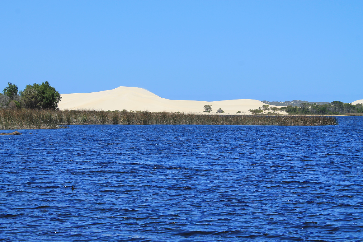
Within the Meerup system there are small, flat or gently undulating areas (Mf) which have been enclosed by dune ridges. These vary greatly in their composition, depending on the nature of the substrate and the manner in which the dunes have moved over the land. Generally, dune sand has blanketed the Mf unit, so that the soil is similar to that in the adjacent dunes. However, as the unrelated substrate is sometimes exposed, this may be a sand or rock surface. Within the Two Peoples Bay Nature Reserve, the Mf units enclosed by the younger dune phases mostly form very swampy areas, which probably were originally part of an inlet linking Kaiupgidjukgidj/Moates Lake and Tyiurrtmiirity/Gardner Lake. Where the Mp dunes have extended onto the plain near the main road, the Mf unit has the same profile as the dunes.
Owingup (O)
The lakes are fringed by the Owingup unit, consisting of low ridges and intervening swales, forming a landscape at ~1 m above water level. The soils are very young and reflect the poorly drained conditions; they consist of layers of organic loam, sand, estuarine shells, and clay. Included are some low benches fringing the ocean in protected situations. These are very wet areas, ~1–2 m above sea level, which are probably watered by springs coming from the adjacent hills. They consist of layers of material including organic loam, grey sand, and bluish-grey clay.
Blackwater (Bw)
This unit occurs near Miialyiin/Angove Lake as a flat landscape composed of sand, 1–2 m above sea level. The water table is at ~1 m and the soil profile is a humus podzol; peaty sands also occur. A small area immediately south of the Gardner Creek has a siliceous surface overlying indurated calcareous clay. Induration may have occurred when carbonate was dissolved from the adjacent dunes, mobilised, and precipitated on the plain.
Islands
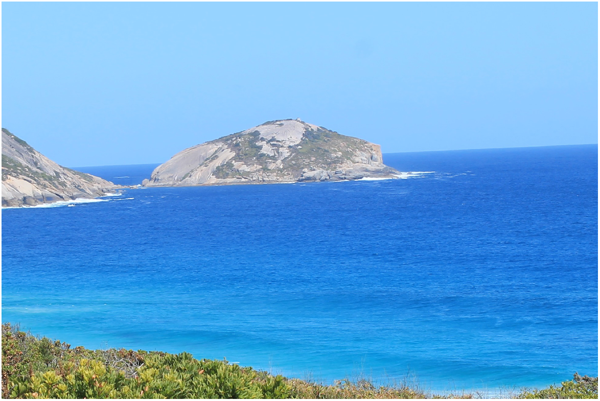
Four islands: Coffin Island; Inner Island; Boyanbelokup/Rock Dunder; and Black Rock are also included in the Two Peoples Bay Nature Reserve. These were not visited by McArthur and Bartle, but from air photo interpretation, Coffin Island appears to be the only one with substantial vegetation (Smith and Kolichis 1980). It has a flat, gently-sloping surface, with shallow granitic soils which support a dense low vegetation. Inner Island may host an area of low vegetation, and False Island, which is connected to the mainland by a thin isthmus, shows similar features (Fig. 7), but the other two appear to be completely barren.
Conclusion
The topography and soils of the Two Peoples Bay Nature Reserve are complex and variable. Surface materials range from soils developed on ancient granite substrates to modern mobile dunefields. Rock substrates are more than 1 billion years old and form part of the Albany–Fraser Orogen. The distribution of these materials can be explained by geological and geomorphological factors. A combination of in-situ weathering processes, transportation of dune sands, and lacustrine deposition have interacted to form this heterogeneous landscape.
Conflicts of interest
Living authors declare no conflicts of interest. Deceased authors had no conflicts of interest at the time of original submission of the predecessor to this paper.
Acknowledgements
W. M. McArthur and G. A. Bartle were contributors to the original version of this paper, which was written for a special bulletin of CALMScience on the natural history of Two Peoples Bay Nature Reserve. The paper was subject to peer review, revised, and accepted for publication in 1991. The special bulletin was never published. In resurrecting the papers collected for the special bulletin, in order to publish them over 30 years later in the special issue of Pacific Conservation Biology, W. M. McArthur and G. A. Bartle were deceased. Accordingly, K.E. and I.T. updated the paper and edited it for publication. W. M. McArthur and G. A. Bartle would have met criteria for authorship if alive, so they are included as authors on this version. Patrick Hesp and Geoff Pickup are thanked for rapid constructive reviews that improved the manuscript. Denis Saunders is thanked for supportive editorial handling, and for providing the opportunity to present this work. Kara Perrilli is thanked for map digitisation.
References
Baker RGV, Haworth RJ, Flood PG (2005) An oscillating holocene sea-level? Revisiting Rottnest Island, Western Australia, and the Fairbridge eustatic hypothesis. Journal of Coastal Research 42, 3-14.
| Google Scholar |
González-Alvarez I, Ley-Cooper A-Y, Salama W (2016a) A geological assessment of airborne electromagnetics for mineral exploration through deeply weathered profiles in the southeast Yilgarn Cratonic margin, Western Australia. Ore Geology Reviews 73, 522-539.
| Crossref | Google Scholar |
González-Alvarez I, Salama W, Anand RR (2016b) Sea-level changes and buried islands in a complex coastal palaeolandscape in the South of Western Australia: implications for greenfield mineral exploration. Ore Geology Reviews 73, 475-499.
| Crossref | Google Scholar |
Hesp PA (2024) Beach and coastal dune systems of Two Peoples Bay Nature Reserve, Western Australia. Pacific Conservation Biology 30, PC24080.
| Crossref | Google Scholar |
Hopkins AJM, Smith GT, Saunders DA (2024) Introduction to the special issue of The Natural History of Two Peoples Bay Nature Reserve, Western Australia. Pacific Conservation Biology 30, PC24023.
| Crossref | Google Scholar |
Knapp L, Cummings D, Cummings S, Fiedler PL, Hopper SD (2024) A Merningar Bardok family’s Noongar oral history of Two Peoples Bay Nature Reserve and surrounds. Pacific Conservation Biology 30, PC24018.
| Crossref | Google Scholar |
Smith GT, Forrester RI (1981) The status of the noisy scrub-bird Atrichornis clamosus. Biological Conservation 19, 239-254.
| Crossref | Google Scholar |
Smith GT, Kolichis N (1980) The flora and fauna of Coffin Island. Western Australian Naturalist 14, 225-228.
| Google Scholar |
Tyler IM, Playford PE, Evans KA (2024) Geology and landforms of Two Peoples Bay Nature Reserve, Western Australia. Pacific Conservation Biology 30, PC24084.
| Crossref | Google Scholar |


